 Coaching Centre
Plate boundaries
What happens at convergent (ocean–continent, ocean–ocean and continent–continent), divergent and transform plate boundaries, the landforms and earthquakes each produces, and how to identify a boundary from evidence such as earthquake depths and mountain heights.
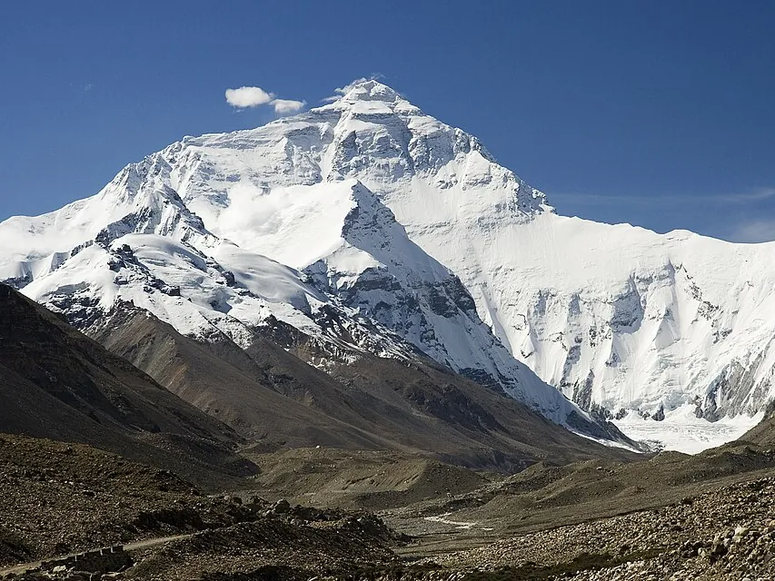
The top of Mt Everest is made of limestone full of fossils of sea creatures. Rock that formed on the floor of an ancient ocean is now 8848.86 m above sea level, pushed up as India has ploughed into Asia for about 50 million years. India is still moving north about 4 cm a year.
Almost all earthquakes, volcanoes and young mountain ranges are found along plate boundaries. There are three main types, named by how the plates move relative to each other.
Convergent boundaries: plates moving together
What happens depends on the density of the two plates.
- Ocean meets continent. The denser ocean plate is subducted (sinks) beneath the continent, forming a deep trench offshore. Water released from the slab makes magma that rises to form a chain of explosive composite volcanoes on land. Example: the Nazca Plate under South America, which formed the Andes, with the Peru–Chile Trench offshore.
- Ocean meets ocean. The older, colder, denser plate sinks under the other. It forms a trench and a curved chain of volcanic islands called an island arc. Examples: the Mariana Islands, Tonga, and Japan. The Challenger Deep in the Mariana Trench is the deepest point in the oceans, about 10 935 m below sea level.
- Continent meets continent. Neither is dense enough to sink far, so the crust crumples, folds and thickens into huge mountain ranges. There are many earthquakes but few volcanoes. Example: India colliding with Asia to form the Himalayas and the Tibetan Plateau.
At subduction zones, earthquakes happen in the sinking slab. Plotted on a cross-section they form a sloping band called a Wadati–Benioff zone, getting deeper away from the trench, down to about 700 km. This was one of the key pieces of evidence that plates really do sink into the mantle. The largest earthquakes on Earth, such as Chile 1960, Sumatra 2004 and Japan 2011, all happened at subduction zones.
Divergent boundaries: plates moving apart
As plates pull apart, hot mantle rises, melts as the pressure drops, and fills the gap with new basalt crust. Most divergent boundaries are mid-ocean ridges, a chain about 65 000 km long that winds through every ocean. They have a central rift valley, many shallow earthquakes and frequent but gentle eruptions. Spreading rates range from about 2 cm a year (the Mid-Atlantic Ridge) to about 15 cm a year (parts of the East Pacific Rise).
When a divergent boundary starts inside a continent, it goes through stages:
- Hot mantle pushes up and stretches the continent. Example: East Africa.
- The crust cracks and a block drops down, forming a rift valley with volcanoes and lakes. Example: the East African Rift, which is slowly splitting Somalia and Kenya away from the rest of Africa.
- The sea floods in to form a narrow sea floored with new ocean crust. Example: the Red Sea.
- The sea widens into an ocean with a mid-ocean ridge down the middle. Example: the Atlantic Ocean.
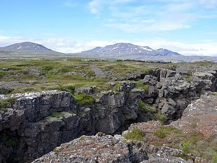
Iceland is one of the few places where a mid-ocean ridge rises above sea level, because a hotspot sits under the ridge. You can stand in the rift valley at Þingvellir between the North American and Eurasian plates. A series of eruptions near Grindavík since 2023 has opened fissures as the plates pull apart.
Transform boundaries: plates sliding past
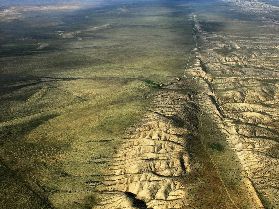
At a transform boundary plates slide past each other sideways. Crust is neither made nor destroyed, and there are few volcanoes, but the plates lock and then slip, causing shallow and often damaging earthquakes. Most transform faults are short offsets that join pieces of a mid-ocean ridge, but a few cut through continents:
- The San Andreas Fault in California, between the Pacific and North American plates. Its 1906 earthquake (magnitude 7.9) and fires destroyed much of San Francisco and killed about 3000 people.
- The Alpine Fault in New Zealand's South Island, between the Australian and Pacific plates. Rocks on either side have been offset by about 480 km. It last ruptured in about 1717 and has about a 75% chance of a large earthquake (around magnitude 8) in the next 50 years.
| Boundary | Plate movement | Earthquakes | Volcanoes | Landforms |
|---|---|---|---|---|
| Convergent, ocean–continent | Together | Shallow to deep | Explosive, on land | Trench, mountain range with volcanoes |
| Convergent, ocean–ocean | Together | Shallow to deep | Explosive island arc | Trench, island arc |
| Convergent, continent–continent | Together | Shallow to intermediate | Few or none | Very high fold mountains |
| Divergent | Apart | Shallow | Gentle basalt | Mid-ocean ridge or rift valley |
| Transform | Sideways | Shallow | None | Long straight fault, offset rivers |
- Look at the height profile and the earthquake depths for each place, then choose the type of boundary.
- Which clue lets you tell an ocean–ocean boundary from an ocean–continent one?
- How can you tell a transform boundary from a divergent one when both have only shallow earthquakes?
- Try to get all seven places right in a row.
Test yourself
Where would you find the deepest earthquakes?
Deep earthquakes occur only in sinking slabs.
The Himalayas formed at a
India collided with Asia.
The Red Sea is an example of
It is stage 3 of continental rifting.
Which feature is NOT usually found at a transform boundary?
No crust is made or destroyed, so there's no magma.
Label the subduction zone.
Put the stages of an ocean forming in order.
Sort the places by boundary type.
Compare the boundary under the Andes with the boundary under the Himalayas. Refer to density, earthquakes and volcanoes.
Both are convergent boundaries. Under the Andes, the Nazca Plate is ocean lithosphere, which is denser than the continental South American Plate, so it is subducted at the Peru–Chile Trench. Earthquakes occur in the sinking slab, from shallow near the trench to deep under the continent. Water released from the slab melts the mantle above, producing explosive composite volcanoes in the Andes. Under the Himalayas, India and Asia are both continental crust, which is too buoyant to sink far, so the crust crumples, folds and thickens into the highest mountains on Earth. There are many shallow and intermediate earthquakes but almost no volcanoes, because no slab is sinking deep enough to release water and make magma.