 Coaching Centre
Australia on the move
How GPS measures the Australian Plate moving about 7 cm a year north-north-east, why Australia's map coordinates had to be updated, Australia's journey from Gondwana and its future collision with Asia, Australia's young and active volcanoes, and First Nations knowledge of eruptions and rising seas.
In 2017 Australia's official map coordinates were shifted 1.8 m to the north-east. The continent hadn't been mapped wrongly. It had moved since the last update in 1994, and phone GPS and self-driving tractors need maps that match where the ground actually is.
Measuring plates with GPS
Wegener couldn't measure continents moving. Today we can. Hundreds of permanent GPS stations (more correctly GNSS stations, since they also use Europe's, Russia's and China's satellite systems) are bolted to solid rock across Australia and the world. Each receives signals from satellites and works out its position to within a few millimetres. Over years, each station's position changes steadily as its plate moves.
The Australian Plate is one of the fastest-moving plates carrying a continent. It moves about 7 cm a year towards the north-north-east, about twice as fast as your fingernails grow. Because the whole plate moves together, Alice Springs, Darwin and Hobart all move at about the same speed and in about the same direction.
To keep maps accurate, Australia uses a coordinate system called GDA2020, which replaced GDA94. Over the 26 years between them, the continent moved about 1.8 m. Australia is also working towards a time-dependent system in which coordinates are updated as the plate moves.
- Choose Alice Springs. Estimate how many centimetres a year it moves north and east from the graphs, then turn on the trend lines to check.
- Compare Alice Springs, Darwin and Hobart. What does this tell you about the Australian Plate?
- Compare the two stations in Iceland. Why are they moving in opposite directions east–west?
- Switch to Fast-forward Australia. How many millions of years until Australia collides with South-East Asia?
At 7 cm a year, how long will it take Australia to move 1000 km?
1000 km = 1 000 000 m = 100 000 000 cm.
100 000 000 cm ÷ 7 cm a year ≈ 14 000 000 years, or about 14 million years.
7 cm a year = 70 mm a year = 70 km per million years. 1000 ÷ 70 ≈ 14 million years.
Australia's journey
About 160 million years ago Australia was still joined to Antarctica in eastern Gondwana, deep in the south. Rifting slowly began to separate them, and from about 85 million years ago a new ocean floor formed between them as Australia started to move north. The last connection, between Tasmania and Antarctica, opened about 34 million years ago. This let a cold ocean current flow right around Antarctica, which helped it freeze over.
As Australia moved north into warmer latitudes, its climate became drier. Rainforests shrank, dry-adapted plants such as eucalypts and wattles spread, and animals such as marsupials evolved in isolation. Australia's northern edge is now pushing into Indonesia, New Guinea and the Pacific. That collision is raising the mountains of New Guinea and Timor, and it squeezes the whole plate, causing Australia's earthquakes. In tens of millions of years Australia is expected to join on to South-East Asia.
Further into the future, models suggest the continents will eventually come together again in a new supercontinent. In one model, Amasia, the Pacific closes and the Americas meet Asia around the North Pole; in another, Pangaea Proxima, the Atlantic closes instead. These predictions are uncertain because the forces on plates change over time.
Volcanoes in Australia
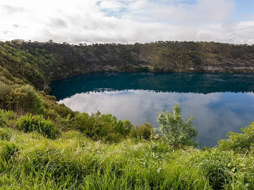
The Australian continent has no active plate boundary, but it does have young volcanoes. The Newer Volcanics Province of western Victoria and south-east South Australia has about 400 volcanoes that erupted over the last 4.5 million years. The youngest, Mt Schank and Mt Gambier (Berrin) in South Australia, erupted about 5000 years ago, so geologists consider the area still active. Scientists are still studying why it formed; one idea is that hot mantle rises where the thick edge of the continent moves over hotter mantle.
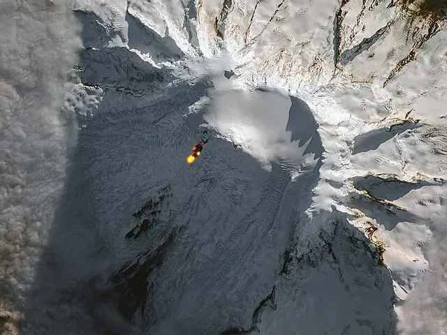
Australia's only volcanoes erupting today are on Heard Island and the McDonald Islands, Australian territory in the Southern Ocean about 4000 km south-west of Perth. Big Ben on Heard Island has lava flows that have been seen by satellite on and off since the 1990s, and the McDonald Islands doubled in area after eruptions between 1992 and 2005.
Test yourself
The Australian Plate moves about
About 7 cm a year, measured by GPS.
Why did Australia's map coordinates have to be updated to GDA2020?
Plate movement adds up: 26 years × 7 cm ≈ 1.8 m.
Where are Australia's currently active volcanoes?
They are Australian territory in the Southern Ocean.
Stories from Port Phillip Bay and Spencer Gulf record
They describe the bays as dry land before the sea rose.
Label Australia's journey.
Put Australia's story in order, oldest first.
Permanent stations show the Australian Plate moves about 7 cm a year -north-east. Australia used to be joined to in Gondwana. Today its northern edge is colliding with South-East , which squeezes the plate and causes inside the continent.
A student says, "Australia is in the middle of a plate, so plate tectonics doesn't affect us." Evaluate this statement using evidence.
The statement is incorrect. Although Australia is far from a plate boundary, it is carried along with the plate: GPS stations show it moving about 7 cm a year north-north-east, and this movement (about 1.8 m from 1994 to 2020) meant the GDA2020 map coordinates had to be introduced. The plate's northern edge is colliding with South-East Asia, and the stress this creates is released on old faults inside the continent, causing about 100 earthquakes of magnitude 3 or more a year, including the deadly Newcastle earthquake in 1989. Australia also has young volcanoes, such as Mt Gambier which erupted about 5000 years ago, and active ones on Heard Island. Plate tectonics affects Australia even though it is not at a boundary.